


TriTown Forest Preserve
- NeHikes
- May 26, 2020
- 2 min read
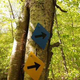
Blue Trail - Moderate (Most Difficult) 5 Miles Loop
Yellow Trail - Easiest 2.5 Mile Loop ,
Red Trail - Exit to trailhead
TriTown Forest Preserve - North Stonington Ct.
Found this trail on AllTrails and it's rated moderate 5 miles blue trail.

Arrived at the trail head and met 2 very nice people that had given us tips on which path to take and stuff to see. Both warned us the blue trail was kind of difficult with elevation.
They weren't kidding. So you trek on down the path from the trail head and come to A blue trail sigh saying Difficult- what does one 1 do but say the hell with it lets go!!! So we head left and down the blue trail we go!

It starts off nice and flat few rocks here and there, no major inclines, we even took a side trail called Bottomland Byway to add extra distance thinking this don t seem that bad. Now that the trees are mostly bloomed its kinda tranquil and most peaceful to be walking around in the woods, hearing all the birds talking away. So you come out of that side trail back into the blue trail , you can either take the other side trail Brook Byway or continue on Blue trail. We decided to skip that one and just head to Lamberts Peak to see the view.
Then you come across a few rock crossings and little stream and start to notice the inclines are creeping up .
Now you can see and feel the inclines at about 1 mile or so in.

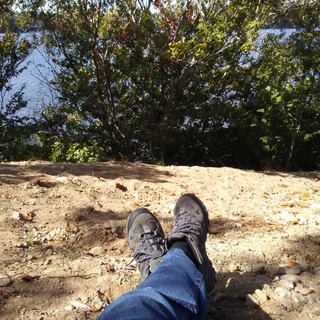
At 1 point I could feel my heart beating on my head and my face was going to spontaneous combust any minute. That's when we reached Lambert peak for this amazing view.


Lambert Peak
Caught my breath, heart stopped pounding out of my chest enjoyed the view .
So.you continue on and Ahhhhhhhh it's all down hill now, how wonderful.
After Lambert Peak you come across this massive rock, it's called Serpent wall.

There's also another little side trail called Cliff Crest Byway, we didn't take that, we just wanted the get to the stream crossing and bridge that was marked on the trail map. Decided to not finish the blue loop and head for the yellow trail which connects to the red trail, the red trail is the exit.


I will go.back and finish the other half of the blue trail, I heard it was easier starting from that end. Plus there is more to see on the other side like Cairns, Rixtown Peak, another serpent wall.
There is a bunch of Native American history in here I was told about , I'm sure you can Google it and find out because I forgot what I was told lol
Found a swamp , say and had a snack and listened to the frogs talk to each other.
Did 3.5 miles and the first 2 i must say we're the hardest .
Bring a good amount of water for this hike, you'll need it!!
#19/100 for the 100 Hikes challenge
HAPPY AND SAFE TRAILS!!!
You said it the first 2 miles of steadily climbing was a challenge! Beautiful place though with all the huge boulders and some really funky trees growing in there. Definitely want to go back for other half. Great day! 😊
Looks like a tough trail. Pics r great. Cant wait to hear how the rest of trail was. Good luck